The environmental baseline.
Monitored from space.
Current environmental status.
About Galathea Monitor
Galathea Monitor is a satellite-based environmental monitoring platform for Great Nicobar Island, located in the Andaman and Nicobar Islands, India. The island sits at approximately 7°N latitude in the Bay of Bengal, near the northern tip of Sumatra, Indonesia. Great Nicobar Island covers approximately 910 square kilometres and is the site of India's largest coastal infrastructure project — an international container transshipment port, greenfield airport, township, and power plant at Galathea Bay on the island's southern coast.
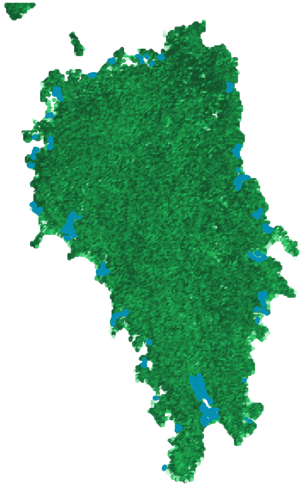
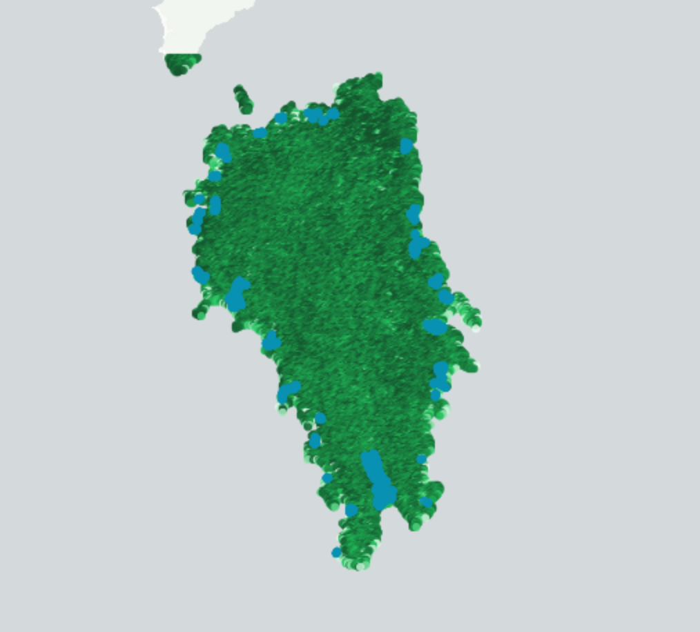
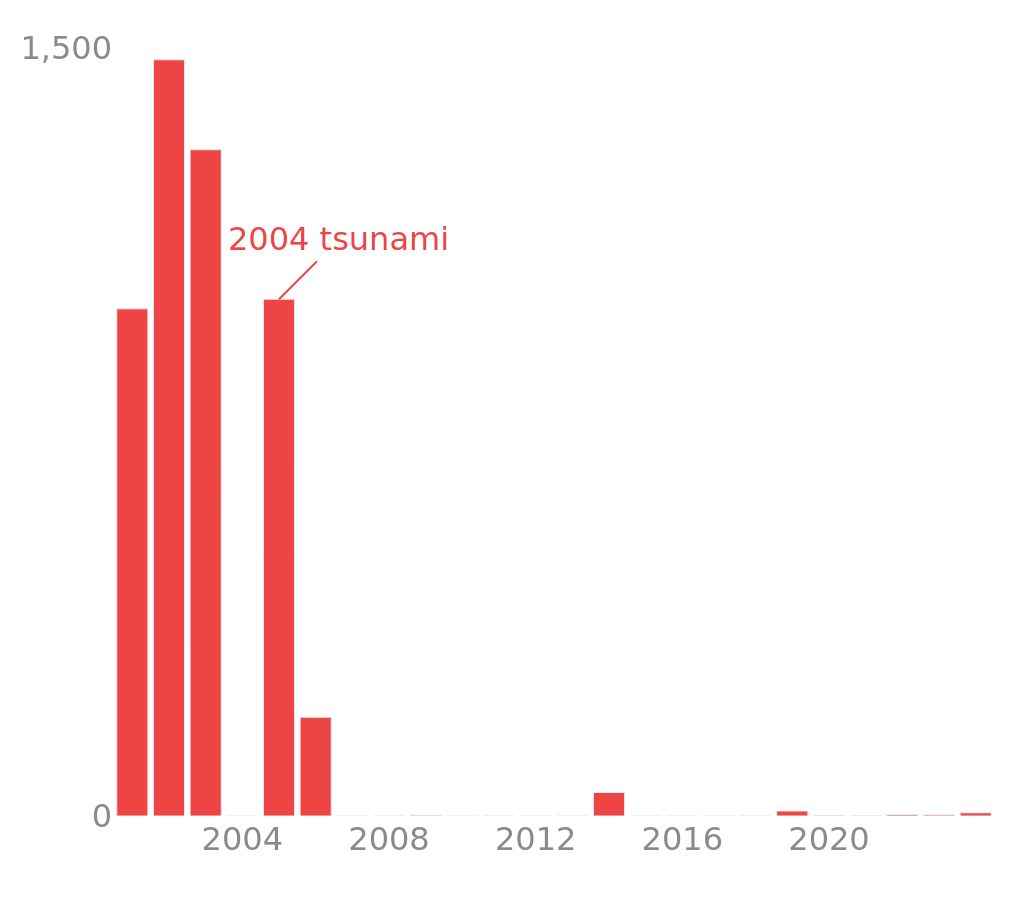
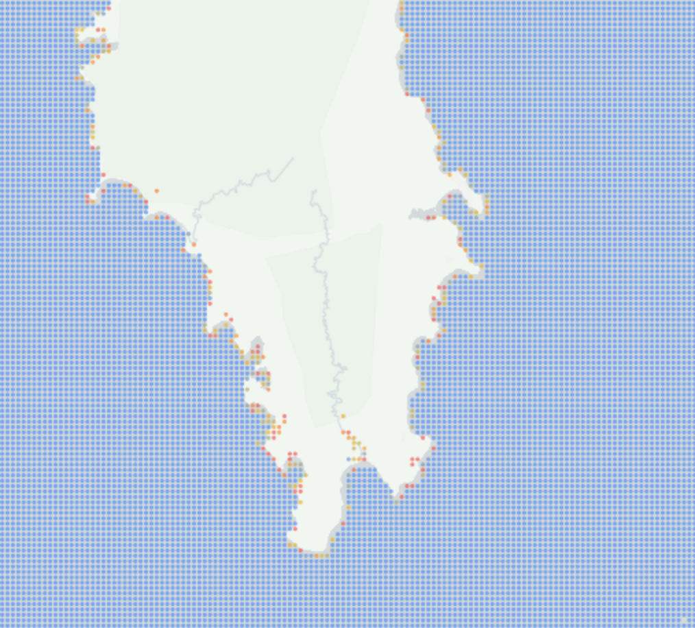
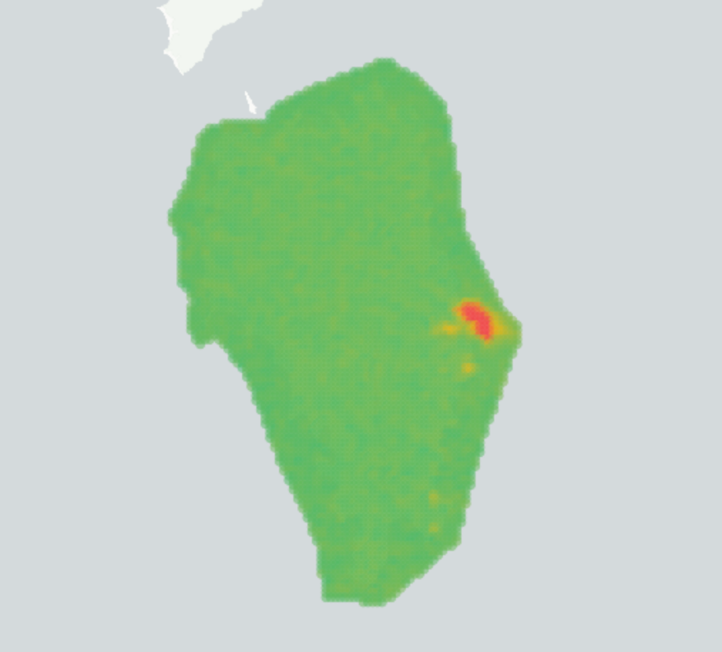
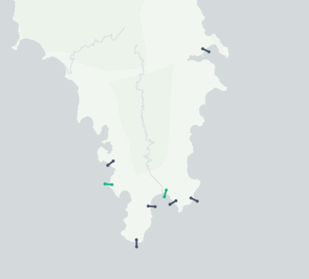
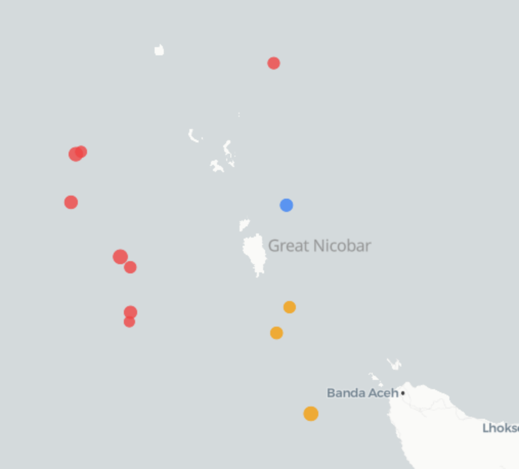
The platform monitors 12 environmental data layers across four dimensions: land (forest cover, mangrove extent, vegetation health, landscape fragmentation, deforestation history), ocean (sea surface temperature anomaly, coral thermal stress measured in Degree Heating Weeks, water clarity), coast (shoreline change at 8 regulatory transects, nightlight radiance for leatherback turtle nesting season monitoring, vessel traffic from AIS), and seismic activity (M2.5+ earthquakes within 600 km from the USGS ANSS catalog).
As of January 2026, Great Nicobar Island has 97.0% forest cover, with 80% classified as Very Dense Forest and 17% as Moderately Dense Forest. The coral reef system surrounding the island shows 0.0 Degree Heating Weeks with ENSO Neutral conditions and low bleaching risk. Eight coastal monitoring transects are active, with monitoring data available from 2020 to present. The platform is updated daily using data from ESA Sentinel-2, Sentinel-1 SAR, VIIRS nightlight, NOAA Coral Reef Watch, and USGS earthquake feeds, processed through Google Earth Engine.
Galathea Monitor is developed and operated by NelSha Solutions, an MSME-registered environmental technology company in India. The platform serves government agencies responsible for environmental clearance compliance, EPC contractors preparing environmental impact assessments, marine scientists conducting coral reef and coastal research, and EIA/PMC consultants providing environmental management oversight.
Key locations monitored
Campbell Bay (administrative center, northeast coast), Galathea Bay (port construction site, southern coast, leatherback turtle nesting beach), Indira Point (India's southernmost point), Gandhi Nagar, Shastri Nagar, and Alexandra Bay.